Lions Gate Bridge Vancouver: National Historic Site Since 1938 — Facts, Traffic & Engineering Data
British ColumbiaConnecting Stanley Park, Vancouver to North Vancouver
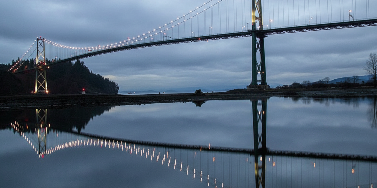
Lions Gate Bridge: Vancouver’s Iconic Suspension Bridge
The Lions Gate Bridge is one of the most recognizable landmarks in Vancouver and a National Historic Site of Canada since 2005. Spanning the First Narrows of Burrard Inlet, it connects Stanley Park and downtown Vancouver to the North Shore communities of West Vancouver and North Vancouver. Its graceful Art Deco towers and dramatic setting against a backdrop of mountains and ocean make it one of the most photographed bridges in the country.
Bridge Facts
| Stat | Details |
|---|---|
| Type | Suspension bridge |
| Total Length | 1,823 m (5,981 ft) |
| Opened | 1938 |
| Daily Traffic | 60,000+ vehicles |
| Lanes | 3 reversible lanes (tidal flow system) |
| Historic Designation | National Historic Site (2005) |
Built by the Guinness Family
The bridge was financed by the Guinness family — yes, the Irish brewing dynasty behind the famous stout. The family had invested heavily in real estate on the British Properties in West Vancouver and needed a bridge to make their development accessible from the city. Construction began in 1937 and the bridge opened on November 14, 1938, at a cost of $6 million — a massive sum during the Great Depression.
The Tidal Flow System
With only 3 lanes serving over 60,000 vehicles daily, the Lions Gate uses a reversible lane (tidal flow) system to manage traffic. During morning rush hour, two lanes flow southbound into Vancouver. In the evening, two lanes reverse to northbound. A movable barrier — operated by a zipper truck — physically separates the lanes. This system has been in place since the 1980s and is essential to keeping traffic moving on one of Canada’s busiest bridges.
The 2001 Deck Replacement
By the late 1990s, the original deck was deteriorating and weight restrictions were imposed. A major rehabilitation project completed in 2001 replaced the entire road deck while preserving the original towers and suspension cables. The project was an engineering feat — sections of the old deck were removed and new panels installed overnight to minimize traffic disruption. The result extended the bridge’s life by decades while maintaining its historic character.
Walking & Cycling
- Pedestrian and cycling path on the east side of the bridge
- Connects the Stanley Park Seawall to Ambleside Beach in West Vancouver
- Stunning views of the downtown Vancouver skyline, North Shore mountains, and freighter-filled harbour
- The walk across takes approximately 20-30 minutes — one of Vancouver’s best free activities